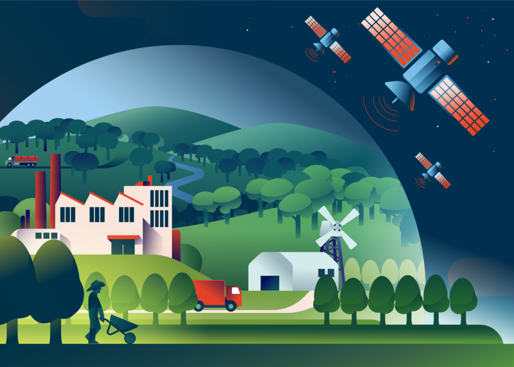
Landscape Monitoring
A Comprehensive Approach to Sustainable Land Management
At DSNG Group, Landscape Monitoring program plays a crucial role in ensuring supply chain compliance with No Deforestation, No Peat, and No Exploitation (NDPE) policies as well as part of our commitment to &Green and ADB. We take a proactive and comprehensive approach to safeguarding our forests, preserving biodiversity, and ensuring the long-term health and vitality of these essential ecosystems.
We employ state-of-the-art techniques and technologies to effectively monitor forest landscapes within and beyond our concession areas. Some of these techniques include:
- Remote Sensing: We utilize satellite imagery and aerial photography to monitor land use changes, detect deforestation, and assess forest health. We have subscribed to Global Forest Watch Pro and Satelligence to receive deforestation alerts.
- Geographic Information Systems (GIS): Our GIS specialists analyze spatial data to identify high conservation value and high carbon stock areas, enabling informed decision-making in land-use planning and conservation efforts.
- Ground Surveys: Our trained teams conduct monthly ground surveys to gather data on flora, fauna, and habitat conditions. We also utilize SMART Patrol as an integrated tool for monitoring our concession and conservation areas, enabling us to collect data on forest cover, wildlife sightings, and human activities. This data helps us detect and address potential environmental risks promptly and inform our conservation efforts.
- Community Engagement: We actively engage local communities in monitoring efforts, encouraging collaboration and knowledge sharing on sustainable forest management.
DSNG monitors deforestation in the landscape associated with its Plantation operations. The areas included in the scope of monitoring (Area of Interest (AoI)) are nucleus plantations, plasma plantations, DSNG supplier independent smallholder plantations, and conservation areas outside concessions managed with communities.
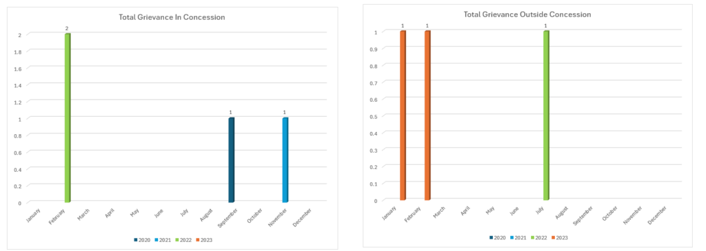
The following is a list of Deforestation Grievance Reports from the Buyer (2020-2023)
DSNG provide attention and ensures follow-up on Grievances given to the Company. The following is a list of Deforestation inside and outside DSNG Concession from the Buyer :

The following table and chart details the 2020-2023 period within and outside the concession:
Satelligence
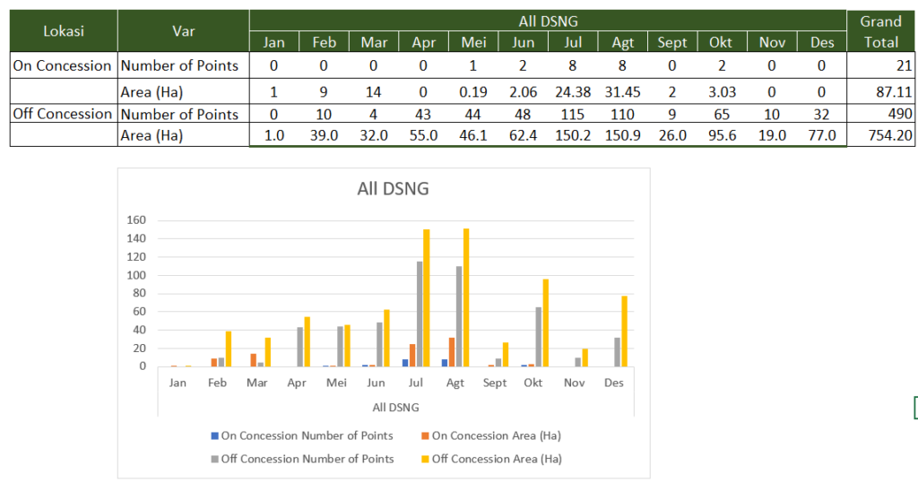
Monitoring is conducted using deforestation alerts from the Satelligence platform and field verification when necessary. DSNG collaborates with Satelligence since 1st December 2022 to monitor real-time deforestation risk monitoring across all company concession areas and its supply base. Click here for more information
During 2023, Satelligence conducted monitoring throughout the DSNG area both inside and outside the concession, with the following results:
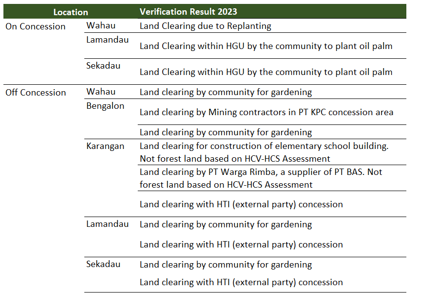
Field verification results showed that some land clearing was caused by the following:
Here’s a look at Satelligence’s collaboration with DSNG in DSNG’s operational areas in Kalimantan and an example of a boundary landscape that includes our supplier areas in DSNG’s subsidiaries, accessible here.